INTRODUCING
BOOKINGS ON WIKICAMPS
Limmen National Park
 Point of Interest
Description
Isolated Limmen National Park offers a wonderful remote park experience, but you will need to be fully self-reliant when you visit. Featuring spectacular sandstone formations, numerous river systems and associated wetlands, it is also steeped in culture and history.
The Park is situated in the Gulf region, about 275 km south-east of Katherine and 65 km from Borroloola. It can be accessed from the Stuart Highway via the Roper Highway (turnoff 10 km south of Mataranka), or via the Carpentaria Highway that runs through the Gulf region from the Highway Inn (near Daly Waters) into Queensland.
Please drive carefully. All roads within the Park are unsealed and can be closed due to seasonal flooding from November to May.
Roads leading to the Park may also be affected by flooding at this time. Check Park road conditions by phoning 1800 246 199, or checking the road conditions website: www.roadreport.nt.gov.au
You should bring your walking boots to see the striking sandstone formations of the Southern Lost City and Western Lost City. You will need a code to get in.
Bird watching enthusiasts can discover extensive birdlife along the rivers and lagoons, while swimmers can head to Butterfly Falls to cool off.
Butterfly Falls is seasonal and can stop flowing in the Dry Season so you may not be able to swim all year round.
Camp in designated campsites only. You can camp at Munbililla (Tomato Island), Limmen Bight River, Towns River, Southern Lost City, Butterfly Falls, Didi Baba, Yurrlmundji or Mountain Creek. There is no pre-booking. Camping fees apply and are payable on-site.
Pets are not permitted.
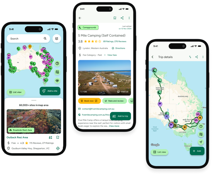
Find this site and more on WikiCamps
Take the ultimate camping companion on your next trip, with these great features:
![]() Explore more than 60,000 sites across Australia with detailed site information at your fingertips
Explore more than 60,000 sites across Australia with detailed site information at your fingertips
![]() Stay in the know with exclusive, insightful reviews from fellow travellers
Stay in the know with exclusive, insightful reviews from fellow travellers
![]() Map journeys, plan your route, and gauge your fuel spend with Trip Planner
Map journeys, plan your route, and gauge your fuel spend with Trip Planner
![]() No signal? No worries! Use offline mode to travel anywhere with WikiCamps
No signal? No worries! Use offline mode to travel anywhere with WikiCamps
![]() Add sites to your collections, search with intuitive filters, and so much more...
Add sites to your collections, search with intuitive filters, and so much more...
Get WikiCamps now!
Download WikiCamps from the App Store on your device.

