INTRODUCING
BOOKINGS ON WIKICAMPS
Mary Kathleen Map
 Point of Interest
Description
Mary Kathleen was a mining settlement in the northwestern part of Queensland. The open-cut uranium mine operated from 1958-63 and again from 1976-82.
No collecting of firewood
Find this site and more on WikiCamps
Take the ultimate camping companion on your next trip, with these great features:
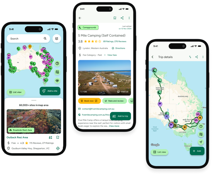
![]() Explore more than 60,000 sites across Australia with detailed site information at your fingertips
Explore more than 60,000 sites across Australia with detailed site information at your fingertips
![]() Stay in the know with exclusive, insightful reviews from fellow travellers
Stay in the know with exclusive, insightful reviews from fellow travellers
![]() Map journeys, plan your route, and gauge your fuel spend with Trip Planner
Map journeys, plan your route, and gauge your fuel spend with Trip Planner
![]() No signal? No worries! Use offline mode to travel anywhere with WikiCamps
No signal? No worries! Use offline mode to travel anywhere with WikiCamps
![]() Add sites to your collections, search with intuitive filters, and so much more...
Add sites to your collections, search with intuitive filters, and so much more...
Get WikiCamps now!
Download WikiCamps from the App Store on your device.

