INTRODUCING
BOOKINGS ON WIKICAMPS
O'Briens Crossing
Description
Camping is not permitted at O'Brien's Crossing.
Camping is permitted at nearby Lerderderg camping area at Upper Chadwick Track. Lerderderg camping area has toilets, picnic tables and fireplaces. Fires are permitted only in the fireplaces provided. Dogs on lead are permitted.
O'Briens Crossing picnic area has toilets and picnic tables. Fires are not permitted at this picnic area.
Walking is a great way to discover the park. From O'Briens Crossing there are a number of walks catering for a range of fitness levels and time constraints.
OBriens Crossing Byers Back Track The Tunnel and return (3km, 1.5 hours)
The track follows an old water race around the steep Lerderderg valley and gives fine views of the river. At the second cross track, turn right and descend steeply to a point opposite The Tunnel.
OBriens Crossing East Walk Cowan Track OBriens Road Short Cut track OBriens Crossing (14km, 5 5.5 hours)
The East Walk follows the Lerderderg River downstream and is rough in places and subject to flood damage. Cowan Track is steep and climbs more than 200 metres from the river to OBriens Road. Return along OBriens Road and Short Cut Track to OBriens Crossing.
OBriens Crossing Lerderderg River Mackenzies Flat (20km, 2 or 3 days)
This is a challenging walk in the Lerderderg Gorge and is for experienced bushwalkers only. It is best to do the walk when the river is fairly low, as many crossings are necessary and at times the riverbed itself is the track. Here you can experience remote, unspoiled bushland.
Find this site and more on WikiCamps
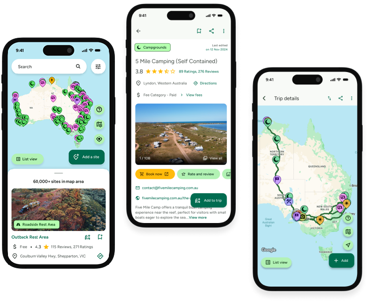
Take the ultimate camping companion on your next trip, with these great features:
![]() Explore more than 60,000 sites across Australia with detailed site information at your fingertips
Explore more than 60,000 sites across Australia with detailed site information at your fingertips
![]() Stay in the know with exclusive, insightful reviews from fellow travellers
Stay in the know with exclusive, insightful reviews from fellow travellers
![]() Map journeys, plan your route, and gauge your fuel spend with Trip Planner
Map journeys, plan your route, and gauge your fuel spend with Trip Planner
![]() No signal? No worries! Use offline mode to travel anywhere with WikiCamps
No signal? No worries! Use offline mode to travel anywhere with WikiCamps
![]() Add sites to your collections, search with intuitive filters, and so much more...
Add sites to your collections, search with intuitive filters, and so much more...

Get WikiCamps now!
Download WikiCamps from the App Store on your device.

